Mapping Our Worlds
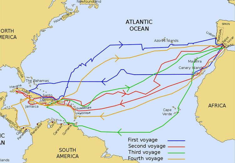
The routes of the four Voyages of Christopher Columbus.
You can get there from here-you just need to start from where your students are. In this lesson, introduce your students to the world of maps and discover a world of information online.
Read below to see how your students can explore the world of maps through printed representations and online versions available through the EDSITEment-reviewed National Geographic Society Xpeditions website. The steps of this lesson are carefully scaffolded to help young children make the shift to viewing the world around them in a two-dimensional format.
Students begin by depicting the familiar terrain of their favorite rooms. In order to understand the concept of boundaries, they then create maps of areas within their classroom. To reinforce the relationship of small to large and the concept of one area nesting within another, students then compare a series of online geographical maps, beginning with a map of their home state and ending with a map of the world.
Finally, students may extend what they have learned by creating maps of other parts of their immediate environments-e.g., routes that they regularly travel.
Note: A shorter version of the lesson could be conducted by skipping Steps 4-5 ("Mapping the World" and "Mapping the Past") and introducing these concepts at a later date.
Guiding Questions
What are maps and how are they used?
What are the purposes of different kinds of maps?
What can maps tell us about our environments?
Learning Objectives
Analyze different kinds of maps and their uses.
Evaluate the motives and outcomes of map making.
Analyze the relationships between maps of different scales (e.g., a world map compared to a map of the United States).